

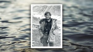
Dr. Pete Rowley was a Geologist with the U.S. Geological Survey from 1970 to 2000. He was leader and member of five small remote USGS field parties (1970-1987) that geologically mapped previously unvisited mountainous areas (about 50,000 square miles, the size of Illinois) in the southern Antarctic Peninsula, the last unexplored mountains on the earth’s land surface. He was USGS Information Scientist during two of the six 1980 eruptions of Mount St. Helens, then did research on the 1980 ash-flow tuffs for three years. Other projects included geologic studies and geologic maps of volcanic fields, mining districts, and other areas in Utah, Nevada, and Colorado. He also taught college geology for three academic years, at Carleton College, Kent State University, and Southern Utah University. Since 2001, he has been a consulting geologist/hydrogeologist, largely making geologic maps for the Utah Geological Survey, Colorado Geological Survey, and Nevada Bureau of Mines & Geology, including a study of earth’s largest ancient landslide complex on land (3000 square miles, the size of Delaware plus Rhode Island), now exposed in southern Utah, and in applying science to find groundwater and to answer other practical questions. He is the author or coauthor of about 250 published research reports and geologic maps. He lives with his wife Dawna Ferris in New Harmony, Utah.